
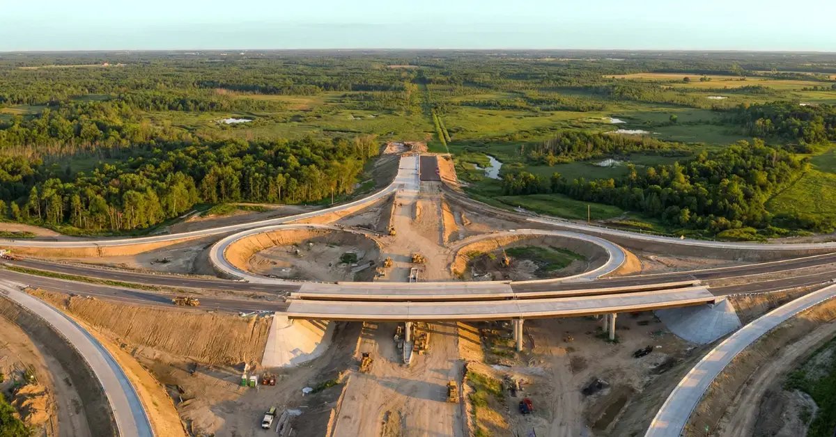
Raw land becomes a business park in a particular order. Roads go in before lots can be sold, water and sewer go in before roads can be paved, and drainage has to work for the whole site before any single lot can be built on. Get the order wrong and a new road is cut open for a pipe the month after it is paved.
Land development infrastructure is the earthwork, utilities, paving and drainage that turn acreage into buildable lots. It covers clearing, mass grading, streets, curb and gutter, water and sewer mains, storm drains, detention, dry utilities, sidewalks and the erosion control that holds it all together while it is built. The product is a lot a builder can pull a permit on.
We coordinate land development work for commercial, industrial and mixed-use sites around Odessa, bringing utility and earthwork trade partners together under one schedule, and coordinating the concrete placement and finishing.
Phasing a development
Development schedules are built in phases, each one producing lots that can be sold or leased. We help owners decide how big a phase should be, since opening too much ground at once invites erosion, security and carrying costs, while opening too little stalls sales. Roads and mains for phase one go in first, with stubs left for phase two.
Inside a phase, the order is firm: clearing, grading, storm drain, sewer, water, dry utilities, subgrade, curb, base, paving, signs. Concrete work such as curb, gutter, sidewalks and ramps follows the base and precedes the asphalt. Missing a step costs a trench cut or a repaved lane.
The heavy earthwork starts with mass grading, which shapes the drainage for the entire phase, and the pond comes early because it catches runoff while the rest is built. Site utilities follow in a fixed order, deepest and gravity-fed lines first. A sewer that must fall by gravity gets its depth before a shallow water line crosses over it, and a pressure line can bend around a manhole when a gravity line cannot.
Why land is being opened here
Odessa and Midland are the named headquarters cities for activity in a Permian Basin of more than 86,000 square miles, where the uplifted Central Basin Platform separates the Delaware Basin from the Midland Basin. Business that follows the basin creates demand for yards, shops, offices and housing, and that demand sets the pace of new subdivisions and business parks.
Oil was first found in Ector County in 1926 on the W. E. Connell ranch, and production from 1926 to 1990 totaled about 2.73 billion barrels, second most of any Texas county. That long history left an industrial base that keeps needing land, and developers keep opening it up along the major roads.
Where a development budget moves
The biggest items are earthwork, utilities and paving. Earthwork depends on the lay of the land, and Ector County's level ground helps. Utilities depend on how far the nearest main is. Paving depends on the traffic the streets must carry, and an industrial street is a heavier section than a residential one.
Off-site costs surprise owners. A road widening, a signal, a lift station or a long extension of a main can exceed the cost of the lots themselves. We ask for these in the first round of due diligence, and we list each one as its own line, so the owner sees what is being bought.
Soil conditions can move the budget as much as distance does. A lot that needs over-excavation or treatment before it can carry a street costs more than one that does not, which is why we recommend borings along the main street alignment before the plat is final. Detention is a similar line item. A basin sized for the whole phase is one of the largest earthwork quantities, and its location decides how much cut is available to balance the fill, so detention and retention ponds are planned alongside the street grades.
Who develops
Commercial developers open retail and office pads along corridors. Homebuilders and multifamily developers open subdivisions and apartment sites with streets, parks and detention built into the layout.
Industrial owners develop yards and parks for their own use, with wide streets, heavy pavements and large detention. Each wants something different from the same sequence, and we adjust the standards to match the buyer. A homebuilder asks about lot grading and sidewalk ramps, an industrial owner asks about turning radii and pavement thickness, and a retail developer asks about driveway spacing and visibility.
Plans, platting and approvals
Development begins with a plat, construction plans and approvals from the city or county. Streets, drainage, water and sewer each have design standards, and the utility owners review their own parts. Texas State Highway 158 forms the northern edge of Gardendale in northeastern Ector County, and development near state highways needs driveway permits and sometimes turn lanes from the state.
Construction brings the stormwater permit, the inspection schedule and testing requirements for subgrade, base, pipe and concrete. We keep the inspection log current and tell the owner which items the city will accept at which stage, so final acceptance of the streets arrives on the date the sales plan assumes. Retests, reinspections and punch lists are normal, and the schedule carries room for them, since they are routine.
What the infrastructure supports
The lots may host a flex or light industrial building, a retail shopping center or a multifamily project. Each wants different things from the infrastructure: truck turning for flex, parking and visibility for retail, internal streets and fire access for apartments.
Planning the infrastructure for several building types at once leaves the owner flexible. A street built to a heavier section can serve a warehouse next year as easily as a shop this year.
Bring the plat and the first phase
Send the plat or concept plan and a phasing idea. We will map the sequence of grading, utilities and paving, flag the off-site items, and give you a cost range you can take to a lender.
Common Questions
How big should the first phase be?
Big enough to deliver lots the market wants and small enough that open ground does not sit idle. We look at utility locations, the main road and the owner's sales plan, then size the first phase so the streets and mains are used efficiently.
Who owns the roads and utilities when they are finished?
Usually the city or utility district after acceptance. Private streets may stay with an owners association. The plan names it early, because ownership drives the design standard and the inspection.
Can concrete streets replace asphalt?
Yes, and in industrial parks with heavy trucks they often do. Concrete costs more up front and lasts longer, and it needs a well-drained subgrade. We quote both, so life-cycle costs sit side by side.
What is the usual first step?
A site walk with the survey and the soil report. We look at the drainage, the utility connections and the access, then build a phasing plan and a cost range the owner can use for financing.
How do you coordinate so many trades?
One schedule, with hold points where the city inspects and where one trade hands to the next. We run a weekly meeting and distribute the lookahead. Trade partners know what is expected on each day and who signs it off.