
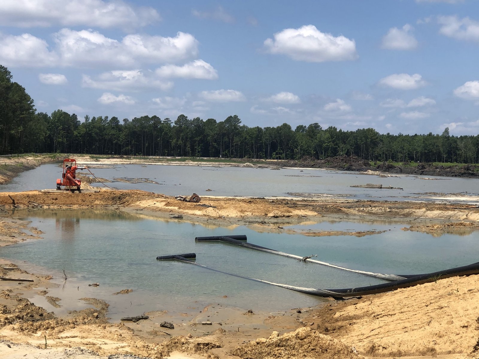
A pond on a West Texas lot is a hole that is dry for most of the year and has to handle a flood in an hour. That mismatch is what makes pond and basin excavation harder than it looks. The volume is set by the drainage study, the floor and side slopes by the soil, and the outlet by the downstream ditch. If any of the three is off, the pond overflows when it matters or holds water when it should not.
Excavation of a pond or basin covers staking the footprint, stripping the topsoil, digging to the design volume, shaping side slopes, building the berm, setting the outlet structure and spillway and protecting the finished surface against erosion. Many basins are also lined, either with compacted clay, a synthetic liner or a concrete section, and some are built with a concrete low-flow channel.
We plan and coordinate pond and basin work for commercial, industrial and public sites around Odessa, with earthwork partners running the equipment and concrete trade partners placing and finishing any concrete inlets, aprons and channels.
Which buildings need basins
Large roofs and large paved areas shed a lot of water, so a distribution center with a truck court needs a detention basin sized for its impervious area. A hospital or clinic campus adds parking decks and drives that make the same demand.
In 2013 the Ector County hospital board approved a $10,035,000 guaranteed maximum price for a two-story expansion of Medical Center Hospital's Center for Health and Wellness, the kind of building addition that adds roof and pavement and may need new or enlarged detention. Whether the owner is public or private, the basin is a permit requirement before it is an amenity, and a parking lot that is added later nearly always forces a second look at the pond.
Basins along the corridors
Odessa is the Ector County seat and is served by Interstate 20, US 385 (Andrews Highway and Grant Avenue), SH 191 (42nd Street) and Loop 338. Basins along these roads receive water from streets and from the lots next to them, and the outfall may be a road ditch that belongs to the state, so approvals follow the owner of the ditch.
We work in the I-20 and Loop 338 corridor and out to Rankin and other Upton County communities. Rankin has held the Upton County seat from 1921 on and became the supply and oil service center for the Yates oil district, so basins there often serve yards and shops.
Dirt by partners, concrete by us
The digging, shaping and compacting are done by earthwork partners that we coordinate. We stake the pond, check depths and slopes, and manage tests on the berm fill. Concrete trade partners place and finish concrete inlets, spillways, flumes, low-flow channels and headwalls, so structures are built to the grades the earthwork set.
The split matters most at the outlet, where a pipe, a headwall and a spillway meet earth. A single plan for all of them avoids the common failure of a spillway that is two inches high. Commercial developers and municipal owners both ask for a single point of contact here, since the pond is where the drainage, the paving and the landscaping contractors all meet.
Slopes, soil and standing water
Side slopes are set for stability and mowing or maintenance access, commonly three horizontal to one vertical. Sand and silt slump if cut steeper, and caliche stands better than either. Dry basins may have a flat floor with a small low-flow channel, which keeps the bottom from turning into a mud flat after small rains.
Water that does not drain is a hazard. A basin that holds water for days breeds mosquitoes and softens its own floor, so the floor is graded toward the outlet and the soil under it tested for infiltration, with the lab report kept in the file. Where the floor is too permeable, a liner may be needed, and where the floor sits on rock, the berm is usually where the work happens. Wind-blown sand also fills a dry basin over time, so the plan leaves room for sediment storage and an access ramp for a loader to clean it out.
What the pond scope covers
A complete scope lists staking, clearing, stripping, excavation, berm construction with tested fill, outlet structure, emergency spillway, side-slope stabilization, seeding or rock lining and a final as-built survey. It also lists the erosion controls that protect the basin during construction, so sediment from the site does not fill it before the owner has a use for it.
Excavating the pond near the start of site work gives runoff a collection point during the remaining construction. That makes erosion control and SWPPP and the pond one plan, and ties both to detention and retention ponds in the design.
Design review and dam rules
The city or county reviews the drainage study and the basin design before construction. Ponds with high berms or large volumes may fall under state dam safety rules, and the engineer confirms which apply. Outfalls into state right of way need the agency's permission.
During construction, the berm fill is tested like any engineered fill, and the outlet is inspected before backfill. The final as-built survey shows that the volume, slopes and outlet elevations match the plan, and that survey is the document the city asks for to release the site.
Large projects shape the drainage
The first I-20 widening segment runs about five miles from east of JBS Parkway to east of CR 1300, and frontage roads are converted from two-way to one-way operation. A change that size alters how water leaves roads and nearby lots, and neighboring owners often need to review their own basin outlets.
Midland International Air and Space Port occupies roughly 1,600 acres about halfway between the two downtowns, with a 9,501 foot runway and an FAA commercial spaceport license dating to September 2014. Large paved facilities like that rely on generous drainage, and smaller projects nearby tie into the same watersheds.
Size the basin before the layout is final
Send the drainage study and the site plan. We will check the basin volume against the available cut, lay out the berm and outlet, and price the excavation and any concrete structures.
Common Questions
How do you size a detention pond?
Sizing comes from the engineer's drainage study, which uses rainfall data, the area of roofs and pavement, and the allowable release rate. We build to the volume on the plans and verify it by survey before we close out.
Can a pond be used for something else?
Dry basins can hold a ball field or a landscaped area if the design allows. Wet ponds can serve as amenities. Both still have to do their drainage job first.
What lining does a pond need?
It depends on soil and use. Compacted clay or a synthetic liner stops seepage in wet ponds. Dry basins in caliche or tight soils may need no liner. The geotechnical report guides the choice.
Who maintains the basin afterward?
The owner, or the owners association in a subdivision. Maintenance includes mowing, clearing the outlet and removing sediment. We hand over a maintenance sheet at closeout.